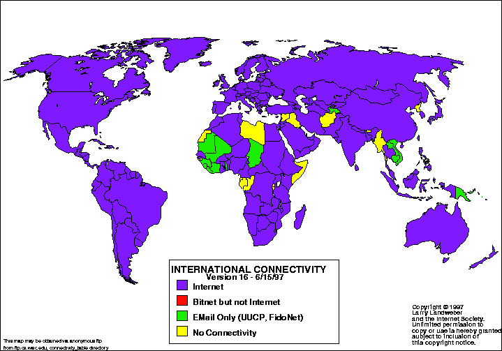
Statistical maps are used to display the distribution of some variable over a specified geographic area, usually defined by political boundaries. An example of a statistical map would be such as the one below, illustrating the distribution of the Internet, or the "connectivity of countries", across the globe.
The basis for statistical mapping is that any kind of data that can be expressed numerically/graphically and varies in quantity from place to place can be mapped.
http://personalpages.manchester.ac.uk/staff/m.dodge/cybergeography/atlas/landweber_version_16.gif

No comments:
Post a Comment